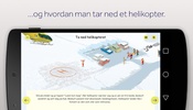
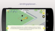
Experience an invaluable tool designed for emergency services with the Luftambulanse app, your comprehensive guide for facilitating air ambulance operations. This application caters to those in critical roles, equipping users with extensive information to evaluate and establish secure landing sites for helicopters. Detailed data regarding weather conditions, potential obstructions, terrain variations, and ground objects are provided in an accessible format that is crucial for a safe touchdown and takeoff.
The main purpose of this platform is to enhance the capabilities of emergency response teams to communicate essential details to helicopter crews. This includes relaying meteorological updates, preparing suitable landing zones, coordinating helicopter deployments at incident sites, assisting with patient transfers, and ensuring a secure departure.
Luftambulanse stands out for providing insights and practical information that can significantly impact the efficiency and safety of emergency medical services. While initially developed for emergency services, educational institutions, and voluntary organizations, the application holds no secrets and warmly welcomes anyone interested in its features.
One of the top features includes user-friendly interfaces and scenarios, converting complex data into actionable insights. Convenience is at the forefront, allowing for swift comprehension and execution of necessary tasks during emergency situations.
By downloading this app, users commit to a tool that can save lives by optimizing response actions and air ambulance operations. Embrace the foresight and precision that Luftambulanse brings to services, whether one is a seasoned emergency professional or an individual eager to understand the intricacies of air rescue operations.
Requirements (Latest version)
- Android 4.2, 4.2.2 or higher required


Comments
There are no opinions about Luftambulanse yet. Be the first! Comment